Citizenship · Nauru
Where is Nauru on the world map: coordinates, neighbors and how to get there

Updated: June 2026·9 min read·Expert reviewed
Terms and costs verified: June 2026
Contents
Nauru is one of those spots on the map that is hard to find the first time: a tiny island in the middle of the Pacific Ocean, just south of the equator. The question “where is Nauru” can be briefly answered as follows: the central part of the Pacific Ocean, the region of Micronesia (Oceania), northeast of Australia. But short means inaccurate, so below we analyze the location of Nauru for real: exact coordinates, nearest neighbors, distances to large countries, time zone and the only real way to fly there. And at the same time, we’ll explain why this remote island has been increasingly sought out over the past couple of years not by tourists, but by investors - because of the young second citizenship program.
Where is Nauru: a short answer in simple language
If you open a world map and look from Australia up and slightly to the right, into the ocean, then somewhere halfway to the equator you will find Nauru. This is an independent state - the Republic of Nauru - and at the same time one of the smallest islands on the planet. The area is only about 21 square kilometers: the island can be circled along the ring road in about twenty minutes.
To make it completely clear where Nauru is, keep three landmarks:
- Pacific Ocean, central part. Not the Atlantic or the Caribbean - precisely the Pacific Ocean, between Australia and Hawaii.
- Just south of the equator. Nauru lies just fifty kilometers from the equator, so the climate here is hot and humid all year round.
- Micronesia. This is a subregion of Oceania, which, together with Nauru, includes Kiribati, Marshall Islands, Palau, Micronesia (FSM).
So when they type “Nauru Oceania” in a search, this is absolutely true: the island belongs specifically to Oceania, to its Micronesian part.
Nauru coordinates: where is it on the world map accurate to the nearest degree
The exact coordinates of Nauru are approximately 0.5 degrees south latitude and 166.9 degrees east longitude. In different sources, the figure fluctuates between 0.52-0.53 S latitude. and 166.91-166.94 E, but this is enough to understand the location of Nauru.
What do these numbers mean in practice:
- Latitude is almost zero. The island is located only 40-53 kilometers south of the equator - it is one of the most “equatorial” capitals in the world.
- Longitude 166-167° east. It is already deep in the Pacific Ocean, closer to the International Date Line than to Asia.
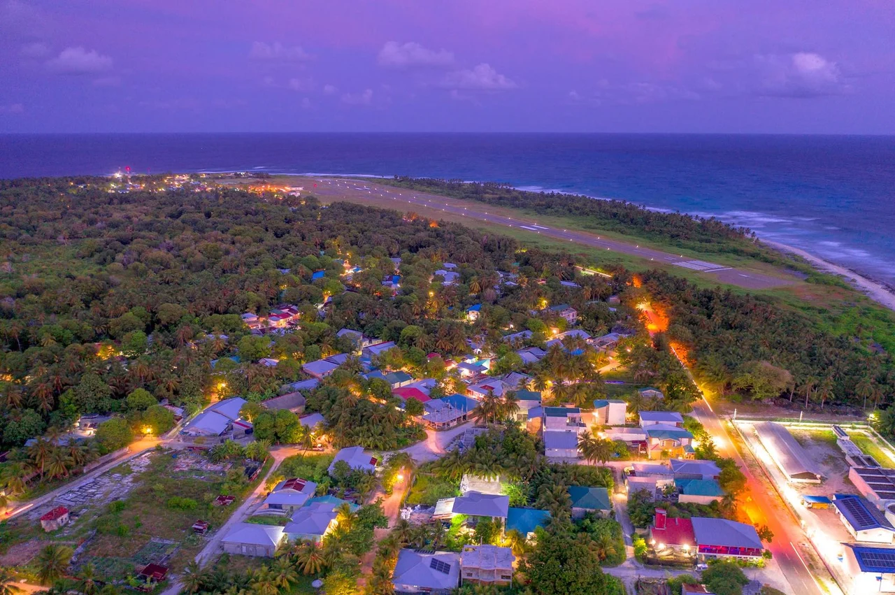
If you enter these coordinates into any map, the mark will fall into the blue emptiness of the ocean, and only with high magnification will a tiny oval of land appear. This is why the request “Nauru on the world map” is so popular: this island is simply not visible on the overview map.
Neighbors of Nauru: who is nearby in the ocean
The main feature of Nauru's location is its isolation. The island has no land borders at all, and the nearest land lies hundreds of kilometers away in water.
- Banaba (Ocean), Kiribati - closest neighbor, about 300 km to the east. This is a small island, also once rich in phosphates, with a fate similar to Nauru.
- Gilbert Islands (Kiribati), including the capital Tarawa Atoll, further to the east and southeast.
- Marshall Islands - to the north and northeast.
- Solomon Islands and the Melanesian archipelagos to the southwest.
- Federated States of Micronesia (Pohnpei) - to the northwest.
All of these are also islands scattered over a huge water area. There is not a single large continental country within a radius of thousands of kilometers from Nauru, and this largely determines both logistics and the nature of local life.
How far to large countries: distances from Nauru
To get a sense of the scale of remoteness, it is useful to estimate the distances from Nauru to familiar landmarks. All figures are approximate, in a straight line (airline).
| Direction | Distance (approx.) |
|---|---|
| Banaba (Kiribati) | ~300 km |
| Tarawa (Kiribati) | ~700-750 km |
| Brisbane (Australia) | ~3300-3350 km |
| Sydney (Australia) | ~4000 km |
| Nadi (Fiji) | ~1800-2000 km |
| Honolulu (Hawaii) | ~4000 km |
Even to the nearest large city - Australian Brisbane - the flight is more than three thousand kilometers. For comparison: this is approximately the same as from Moscow to Lisbon. Only under the wing is not Europe, but a continuous ocean.
Nauru time zone: island time
Nauru lives in UTC+12 time. This is one of the “earliest” time zones on the planet - the island greets the new day almost first in the world, along with New Zealand, Fiji and the Marshall Islands.
A few practical guidelines:
- Moscow. Nauru is 12 hours ahead of London and 9 hours ahead of Moscow: when it is noon in London, it is already midnight on the island.
- Brisbane (Australia). Nauru is 2 hours ahead.
- There is no summer time change. Time on Nauru is constant all year round, making it easy to schedule calls and meetings.
For remote matters - and the second citizenship of Nauru is issued remotely - the time difference hardly interferes: communication takes place via e-mail and through a representative, and not through live calls at an inconvenient hour.
How to get to Nauru: by plane only
There are no scheduled passenger flights to Nauru, nor are there regular ferries. The only real way to get to the island is by plane. And here there is only one monopolist.
- Nauru Airlines is the national carrier and in fact the only airline flying to the island. Airport - Nauru International Airport (code INU).
- The main hub is Brisbane (Australia). The direct flight takes about 4.5 hours and operates several times a week. This is the most convenient entrance for travelers from Europe and the CIS - with a transfer in Australia.
- Nadi (Fiji) - a second convenient connecting point, especially for those flying from America or East Asia.
- Regional flights connect Nauru with Tarawa (Kiribati), Majuro (Marshall Islands), Pohnpei (FSM) and other points of the Pacific Ocean.
The schedule changes seasonally, and the number of flights is small, so the trip is planned in advance. But this remoteness is part of the island's appeal: people don't come here by accident.
Why is Nauru so small and yet a separate country?
Nauru is the smallest republic in the world and the third smallest state in terms of area after the Vatican and Monaco. But at the same time, it is a full-fledged independent country, a member of the UN, with its own government, flag and passport.
A few facts that help you understand the island:
- Population - about 12 thousand people.
- There is no official capital de jure, but the government district is Yaren, where the parliament and airport are located.
- Languages - Nauruan and English.
- Currency - Australian dollar (AUD).
- Economy historically relied on the extraction of phosphates (fossilized guano). Now the deposits are mostly depleted, and the country is looking for new sources of income.
It was the search for a sustainable economic model - also against the background of climate risks for the low island - that led Nauru to launch the second citizenship program. More on her later.
Nauru flag: how the island showed its coordinates
An interesting detail directly related to the theme of “Nauru on the map”: the location of the island is encrypted in its flag. On the blue surface (blue is the Pacific Ocean) there is a narrow yellow horizontal stripe - this is the equator. And just below the stripe there is a white twelve-pointed star - the island of Nauru itself.
That is, the flag literally says: “we are a small point of land right under the equator, in the middle of the ocean.” The twelve rays of the star symbolize the twelve original tribes of the island. It turns out that even without opening the atlas, you can understand from the flag where Nauru is located - just south of the equatorial line in the blue Pacific Ocean.
“When a client first sees Nauru on a map, the reaction is almost always the same: “Where is that anyway?” The island is really tiny and very remote - the center of the Pacific Ocean, almost on the equator, thousands of kilometers of ocean around. But in investment migration, geography works differently than in tourism. There is no need to fly anywhere: the program is completed completely remotely, and the physical distance to the island does not affect the process. It is much more important to soberly understand what a Nauru passport does and does not provide. This is not a document for visa-free Europe or the USA, but a tool for specific tasks - a backup document, mobility in a number of Asian and Pacific destinations, flexibility in tax planning. The program is young, so examination and careful compliance are especially important. I always call the remoteness of the island not a disadvantage, but a feature: such a decision is made consciously, and not by chance.”
Climate and nature: what it's like to live almost on the equator
Since Nauru lies a few kilometers from the equator, the climate here is equatorial maritime: hot and humid all year round, the temperature usually stays around 25-35 degrees. There are no distinct winters and summers - there are wetter and drier seasons.
The island itself is a raised coral atoll. Along the perimeter there is a narrow strip of fertile land with beaches and settlements, and in the center there is an elevated rocky plateau where phosphates have been mined for decades. Because of this mining, parts of the interior have been greatly altered, and land restoration is one of the tasks to which the country is now directing funds, including from the citizenship program.
What is Nauru often confused with?
Due to similar names and remoteness, Nauru is often confused with other places. Let’s break it down so you don’t get lost on the map:
- Nauru and Vanuatu - different states. Vanuatu is Melanesia, to the south and west, with its own citizenship program.
- Nauru and Palau - also different countries of Micronesia, Palau lies much further west, closer to the Philippines.
- Nauru and Marshall Islands - neighbors in the region, but these are separate states.
- Nauru and New Zealand - they are only related by the UTC+12 time zone, otherwise they are completely different points on the planet.
In short: Nauru is exactly that single circle of land almost on the equator, at 166-167 degrees east longitude. It is almost impossible to confuse its coordinates with something else.
Why are investors increasingly looking for a remote island?
For a long time, Nauru was of interest mainly to geographers and lovers of rare stamps in the “visited all countries” collection. But over the past couple of years the picture has changed. The reason is the young government program for second citizenship by investment.
The logic is simple. Nauru is a low-lying ocean island for which rising sea levels are not an abstraction, but a real risk. To finance climate resilience and the relocation of residents from flood zones, the country launched a program in 2024 under which a foreign investor makes a non-refundable contribution to a special fund - and in return receives citizenship.
Thus, the remoteness of the island turned from a disadvantage into part of the offer: a passport is issued completely remotely, without moving to this piece of land thousands of kilometers from home.
Nauru citizenship by investment: the main thing about the program
The program is called the Economic and Climate Resilience Citizenship Program (ECRCP) - an economic and climate sustainability program. Here are its key parameters (the figures are approximate, current thresholds are specified at the time of contact):
- Contribution. A non-refundable payment to the fund starts from approximately 90,000 USD per applicant within the current preferential window (according to a number of sources - until 06/30/2026), then the threshold rises to approximately 105,000-115,000 USD. For family members - additional amounts.
- No accommodation. Relocation and physical presence on the island are not required - registration is completely remote.
- Deadlines. Approximately 3-4 months (about 85 days) with a clean file.
- Examination. Mandatory due diligence and source of funds.
- Dual citizenship. Nauru allows it - there is no need to give up your first passport.
It's important to be : the program is young, and the Nauru passport is not a “super passport.” There is no direct visa-free travel to Schengen, the USA, Canada or Australia. Really convenient destinations are the UAE, Singapore, Hong Kong, Malaysia, South Korea, a number of countries in Oceania and some countries with a visa on arrival. The power of the document should not be exaggerated.
Detailed analyzes are in the materials: country Nauru, Nauru Island, Nauru citizenshipandNauru citizenship by investment. Full conditions and calculations for your family are on the program page: Nauru citizenship by investment.
Receive a personal quote and verification of eligibility.
Taxes and who is eligible for Nauru citizenship
A separate interest in Nauru is related to taxes. The Republic does not impose ordinary income tax on the worldwide income of individuals - this may be attractive for international tax planning.
But here we need to be careful. Citizenship alone does not automatically make you a tax resident of Nauru. Real tax residency is determined not by a passport, but by where a person actually lives and where his center of vital interests is located. Therefore, second citizenship of Nauru is a tool that works only in conjunction with a competent personal tax strategy.
Who the program may be suitable for:
- those who need a backup document and freedom of movement to a number of Asian and Pacific destinations;
- entrepreneurs building an international structure with a view to flexible tax planning;
- families who need the opportunity to register remotely, without moving.
Citizens of Russia and the CIS countries can participate strictly within the law, with enhanced compliance and verification of the source of funds. It is also important to remember the obligation to notify your country about your second citizenship and to complete everything correctly.
Bottom line: where is Nauru and what to do about it
Let's put it all together. Nauru is located in the central Pacific Ocean, in Micronesia (Oceania), just south of the equator - at coordinates of about 0.5 degrees south latitude and 166.9 degrees east longitude. The closest neighbor is Banaba Island in Kiribati, Australia is more than three thousand kilometers away, the time on the island is UTC+12, and you can only get there by Nauru Airlines, most often through Brisbane.
This is one of the most remote and smallest corners of the planet - and at the same time an independent state with its own second citizenship program. If you are not interested in geography for the sake of curiosity, but in the practical question of whether you should consider a Nauru passport for your family, the right next step is a personal consultation with a analysis of the strengths and weaknesses of the program.
Discuss Nauru citizenship with a BRIDGES GLOBAL expert.
Expert commentary
A professional assessment of the location of Nauru and its role in investment migration.
Frequently asked
Questions people ask before deciding
01Where is Nauru?
Nauru is located in the central Pacific Ocean, in the Micronesia (Oceania) region, just south of the equator. This is an independent island state northeast of Australia, coordinates are approximately 0.5 degrees south latitude and 166.9 degrees east longitude.
02Where is Nauru in simple words?
This is a tiny island in the middle of the Pacific Ocean, almost on the equator, between Australia and Hawaii. In area (about 21 sq. km) it is one of the smallest in the world and the smallest republic on the planet.
03What are the coordinates of Nauru?
Approximately 0.5 degrees south latitude and 166.9 degrees east longitude. In different sources, the numbers are slightly different (0.52-0.53 S and 166.91-166.94 E), but this is enough to understand where the island is on the world map.
04Is Nauru part of Oceania?
Yes. The query “Nauru Oceania” is absolutely correct: the island is part of Oceania, in its subregion Micronesia, along with Kiribati, the Marshall Islands, Palau and the Federated States of Micronesia.
05Who is Nauru's closest neighbor?
The nearest land is Banaba (Ocean) Island, part of Kiribati, about 300 km to the east. Nauru has no land borders at all, there is only ocean around.
06How far is it from Nauru to Australia?
The distance to Brisbane in a straight line is about 3300-3350 km, a direct flight takes about 4.5 hours. Sydney is about 4000 km away.
07What time zone is Nauru?
Nauru lives on UTC+12 time, without changing clocks. The island is 12 hours ahead of London, 9 hours ahead of Moscow and 2 hours ahead of Brisbane (Australia).
08How to get to Nauru?
Only by plane. Regular flights are operated by the national carrier Nauru Airlines, the main hub is Brisbane (Australia), with convenient connections also via Nadi (Fiji). There are no scheduled sea passenger services.
09Why is Nauru so difficult to find on the map?
Because of the size. The island occupies about 21 sq. km and is lost in the blue of the ocean on overview maps. It is easier to find it by coordinates (about 0.5 S, 166.9 E) with a strong magnification.
10How is Nauru different from Vanuatu and Palau?
These are three different countries. Vanuatu - in Melanesia, to the south and west. Palau is also Micronesia, but much further west, closer to the Philippines. Nauru is a separate island almost on the equator at 166-167 degrees east longitude.
11What does citizenship have to do with it if this is an article about geography?
In recent years, not only tourists have been searching for the remote island. Since 2024, Nauru has had a government program for second citizenship by investment (ECRCP), which is issued remotely - there is no need to move to the island.
12Is it possible to obtain Nauru citizenship remotely without coming?
Yes. The ECRCP program does not require residence or physical presence: registration takes place remotely, through a non-refundable contribution to the state fund and a security check. For Russians and citizens of the CIS, participation is possible strictly within the framework of the law, with enhanced compliance. Details and calculations are on the page /citizenship/investment/nauru/.
Transparency
How this material was prepared
- Author
- Darya Melnik, senior Investment Programs Advisor, BRIDGES
- Terms and costs last verified
- June 2026
- Sources
- official government authorities of the relevant country and state publications
- Methodology
- government minimum requirements are stated separately from due diligence charges, state fees, legal and banking costs
Sources and methodology
Figures, terms and timelines are checked against official sources as of June 2026. Link availability verified in August 2026. Third-party blogs and agent websites are not used as a source of programme terms.
- [1]EUR-LexOfficial texts of European Union legislationeur-lex.europa.eu/homepage.html
- [2]European Commission - Migration and Home AffairsEntry and residence rules in the EUhome-affairs.ec.europa.eu/index_en
Methodology: tables and charts state government minimum investment requirements; due diligence charges, state fees, legal, banking and other costs are calculated separately and are not included in the minimum thresholds.
About the author
Related materials
What to read next
 ComparisonNauru or Caribbean Citizenship: Investment Program Comparison
 AnalysisWhat is due diligence and why the Caribbean is rejecting applications
 ArticleArea and size of Nauru: how small is this country
Personal programme selection is conducted by Anna Kovalevskaya, Head of Legal, BRIDGES.
Citizenship of Nauru: preparation checklist
Documents prepared in advance, source of funds checks and where applications usually fail.